 When I heard about the off road bike packing route that combined a number of famous Scottish trails from Inverness to Glasgow called The Badger Divide I knew i had to do it as my first bike packing adventure. The race/challenge aims to complete it in 2 to 3 days however I wanted to really enjoy the experience and soak up the vastness and views so chose to ride it over a more leisurely 5 days.
I thought it might be useful for others to read how we did it, where we stayed and the route we took, so I am documenting it here.
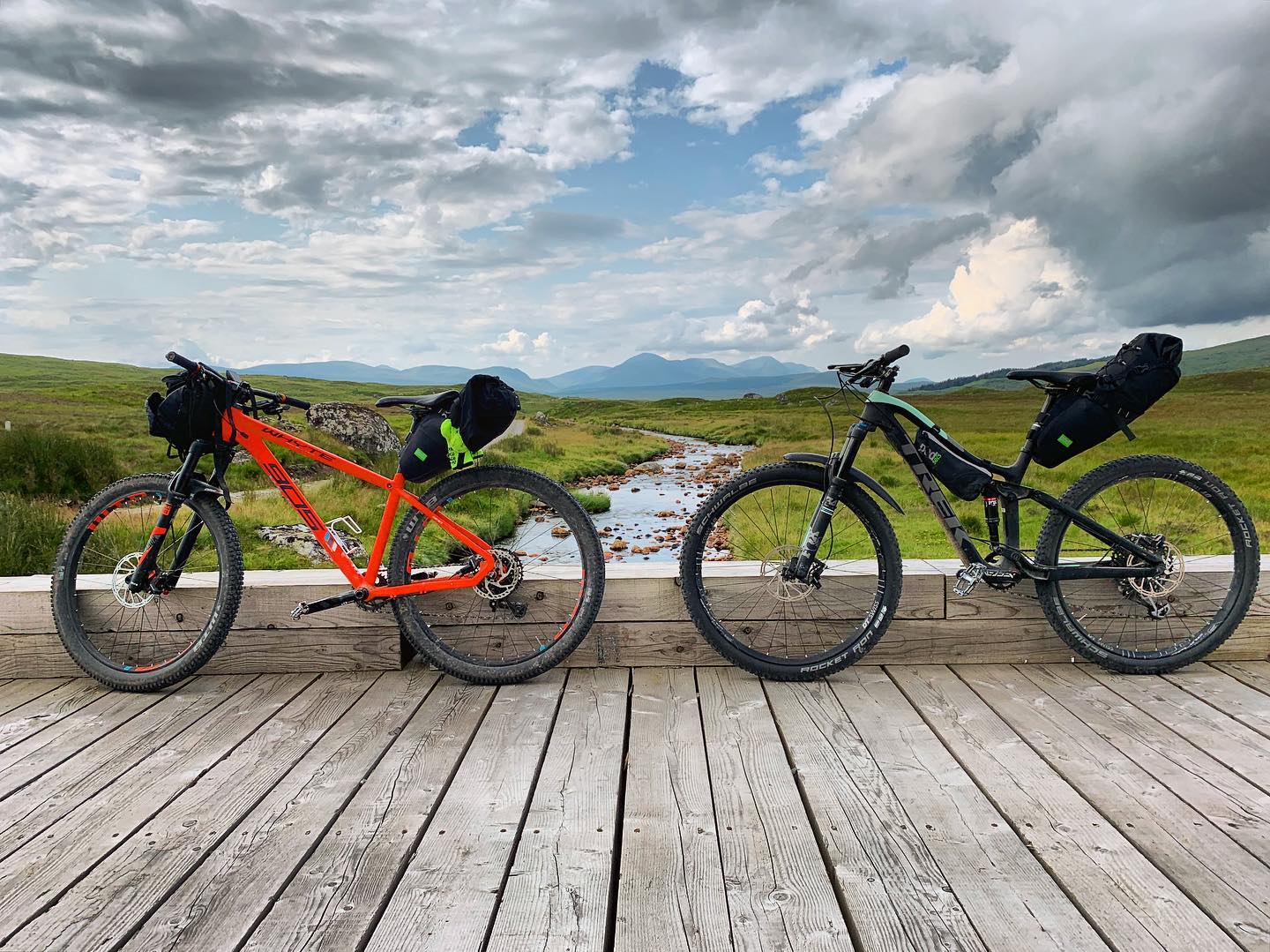
Equipment:
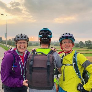
The first challenge was to get to Inverness to start the adventure. There were 3 of us riding and the train only had space for 2 bikes, while we could have gone on different trains, they still seemed to be booked up so I hatched another plan to hire a van from Glasgow Airport and then drop it off at Inverness Airport. This also meant my own van would be waiting at the end ready to transport us home.
Upon arrival at Inverness we got the bikes out and the adventure began! We had just enough daylight left to ride into the centre of Inverness where we spent the night at a hostel.
Day 1 – We all slept well, and breakfast was provided at the hostel so we fuelled ourselves up ready for our first day which was to tackle the Great Glen Way to Fort Augustus. It was a pretty hilly day, but on good tracks and stunning scenery, 2 hours into our ride we came across a quirky eco cafe (Abreachan eco cafe) which was basically a couples home that they had opened up to wild campers and were open 24hours a day 365 days a year for amazing coffee and cake. So of course we had to trial what was on offer 🙂
We then pedalled on to more forest trails and finally Loch Ness came into view, then we had some awesome fun single track in the woods down to Drumnadrochit. Followed by another tough climb out the other side. We were very lucky with the weather, it was very still & humid and about 22 degrees. If anything we were too hot, but no complaints there! It was a pretty tough first day with a lot of climbing and we stopped 10km before the finish to fuel up at Invermoriston at a lovely pub before the final few undulations into Fort Augustus and Morags Hostel. The hostel was a great wee find, a hive of activity, 4 bed dorms, good shower and clean. They even made us a packed lunch for the next day as we knew it was going to be very remote with no chance of food stops. (Stats: 67km | 1400m elevation).
GPX ROUTE – DAY 1
Accommodation – Morags Lodge Hostel


Day 2 – Another good nights sleep and breakfast at the hostel and we were on our way again. Our first challenge of the day was the mighty Corrieyairack Pass which took us up to over 800m above sea level. Yet again the morning mist cleared and another windless sunny day was instore. When we turned up to the start of the pass it was very over grown, but we battled our way through shredded and attacked by plantation. It didn’t last long and we were soon back pedalling again up a steep wide rocky track. Greeted by some workman digging a trench in the first 1km who told us about the monster that awaited us and that we had barely even begun. Great!
 We made a note every hour to eat today as lack of food took its toll the day before so we had to be strict with ourselves to eat regularly. The first 16kms was all uphill and it took us 3 hours to the summit. We stopped at the top admiring the views and what we had tackled and had our packed lunches the hostel had made for us. Very nice they were too!
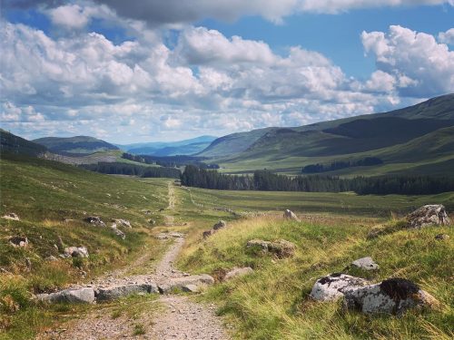 It was then steep downhill switch backs over very rough, loose rocks and boulders, I was feeling very relived that I had my mountain bike & not my gravel bike at this point! Along with some huge water bars across the trail it made for a technical & long descent. Though it soon smoothed out and a lovely long single track semi tarmac descent brought us down to the source of the river Spey where there was also a lovely Bothy which we had a nosey inside.
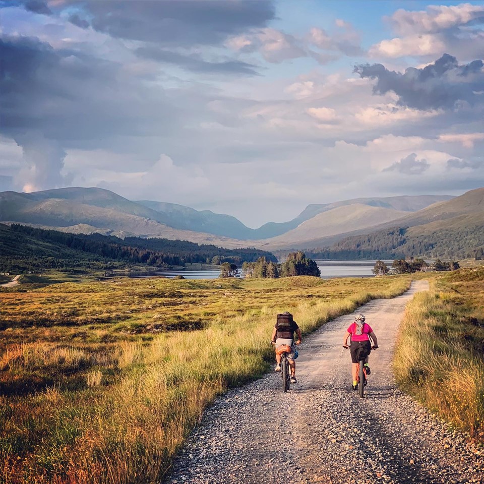
We headed right before Laggan through a lovely forest trail and fallow deer park down to Loch Laggan. A 10km smooth road ride was then ahead of us to the turning off for the final climb up and over to Loch Ossian where we would be spending the night. We knew there was a restaurant at Corrour Station just 2km from the hostel so we had a target and wanted to arrive before 7pm to make sure we got fed.
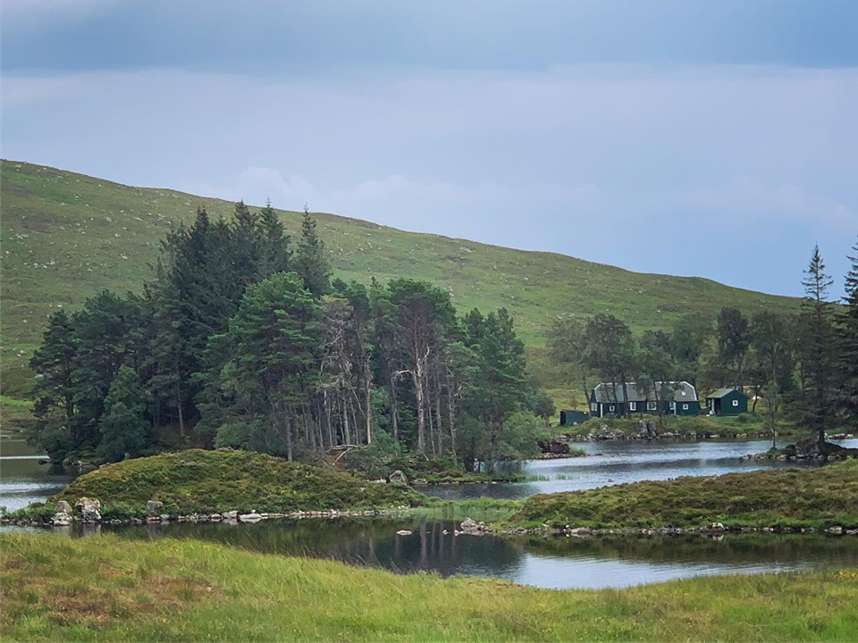
This section of the ride was probably my favourite of the day, it was a well maintained gravel track and gradual winding ascent. I was also treated to seeing a Pine Martin trotting across the track and then the view of Ben Nevis in the distance. It felt so remote and peaceful, and yet again not a breath of wind. We arrived at Loch Ossian with plenty of time and went straight to the restaurant/station for beer and food before heading back to the eco youth hostel. It was a truly magical place, despite the swarms of midges! There was something magical about being in the middle of nowhere with no road access. (Stats: 75km | 1450m elevation).
GPX ROUTE – DAY 2
Accommodation – Loch Ossian Youth Hostel


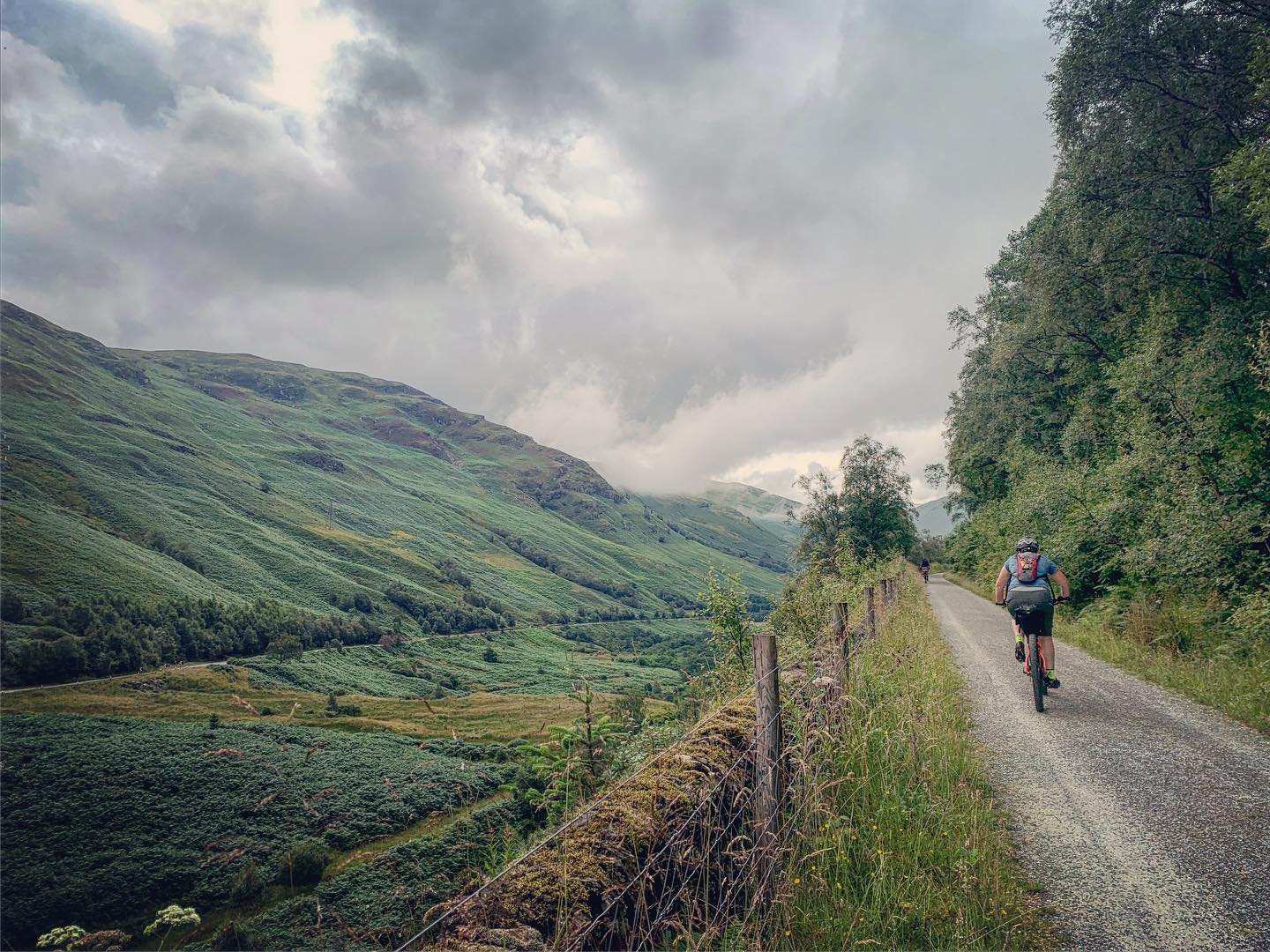
Day 3 – I woke early as usual so went for a short run along the edge of Loch Ossian, my legs were not very impressed so I only ran for 20 minutes. We then all got ourselves organised and headed back to the restaurant at Corrour station for some breakfast to get us through another remote morning into the wilderness. Our first climb was stunning up a lovely surface that tracked along the side of a mountain, again we could see Ben Nevis with clouds hugging the sides. We were rewarded with a stunning descent down to Loch Rannoch which was wicked fun. Some easy miles on a quiet tarmac road that tracked along the edge of the loch. We stopped for lunch which consisted of bread pockets & dairy lea slices that we had carried with us from Fort Augustus. A perfect energy booster to get us up the beautiful single track forest climb. At the top we had a short section of peaty wetness on the track which was actually really fun as it took some concentration to find the right line.

Then it was a fast rocky descent down to Bridge of Balgie where we lucked upon a lovely Tea room and post office. We stopped for tea before heading off up the final drag up the valley floor before the hurl over the hurl to Killin. It had been another hot still day and we could see storms gathering. Ahead of us we could see the rain pouring on the hill side, we kept going and it started to rain quite hard so we took shelter under a bridge. We were doing well for time and could see the storm was moving slowly away from us. After 10 minutes the rain had stopped and we headed back out, we could see the fork lightning ahead but kept going slowly hoping it would continue to move away. Which fortunately it did.
As we turned left to head up a steeper road which was sort of tarmac but not really any good for a car we could see the streams next to us filling down the hill, going from streams into raging torrents of water before our eyes, it was pretty impressive. Our luck finally ran out though once we went over the top and we saw the next storm directly over Killin. We just put our heads down and ploughed on hard to get through it, we arrived at Killin Hotel soaked to the bone! But it made for an exciting end to the day. Fortunately the hotel had a lovely restaurant and we were well fed and set the hairdryer and heaters to work on our wet clothes and shoes. (Stats: 85km | 1100m elevation).
GPX ROUTE – DAY 3
Accommodation – Killin Hotel


Day 4 – Today was a much easier day through Loch Lomond and The Trossachs and with such different scenery from the remoteness of the previous 2 days. Equally beautiful though, and the difference of each day is what makes this route so special. We started with a gentle climb along a disused railway line out of Killin and then up through Forestry on some very well kept trails, we were now on the Rob Roy Way and Sustrans Route 7. At the top of the first climb we crossed the road and went over the stunning viaduct at Glen Ogle and downhill for what felt like ages! The miles were lashing by and we were feeling good.
 We stopped at Strathyre for a coffee at a small shop and then continued on the track around the edge of Loch Lubnaig where we stopped again for lunch at a Forest Lodge holiday place. The lunch was good when it finally came but it was rather slow. It was ok though as it felt very much like a recovery day and we were just enjoying the scenery and easy tracks.
We were still tracking along Route 7 and tracked along the edge of Loch Venachar which was really quiet so we stopped for a wild swim. We continued around the edge of the loch and then up a gravel track called the 3 Lochs Route and up and over into Aberfoyle which was a super fast descent! (Stats: 54km | 700m elevation)
GPX ROUTE – DAY 4
Accommodation – Rob Roy Hotel


Day 5 – Our final day took us through a lovely peaceful forestry path up a lumpy climb before descending down into Dryman and onto the West Highland Way. We had one interesting bridge to navigate over that was not made for bikes but this has been the only non bike friendly element of the whole route and we made it over 🙂 There was a short section along an A road but not for long and we soon turned off again onto the West Highland Way where we had to navigate around a lot of walkers but all seemed very friendly and smiled whilst moving to the side slightly to let us pass by.
We had a mixture of rocky climb, tarmac and single walking track weaving our way to Milngavie the final destination of The Badger Divide. It was another lovely day but in the back of our minds was the traffic battle through Glasgow we had to come to get to the Airport.
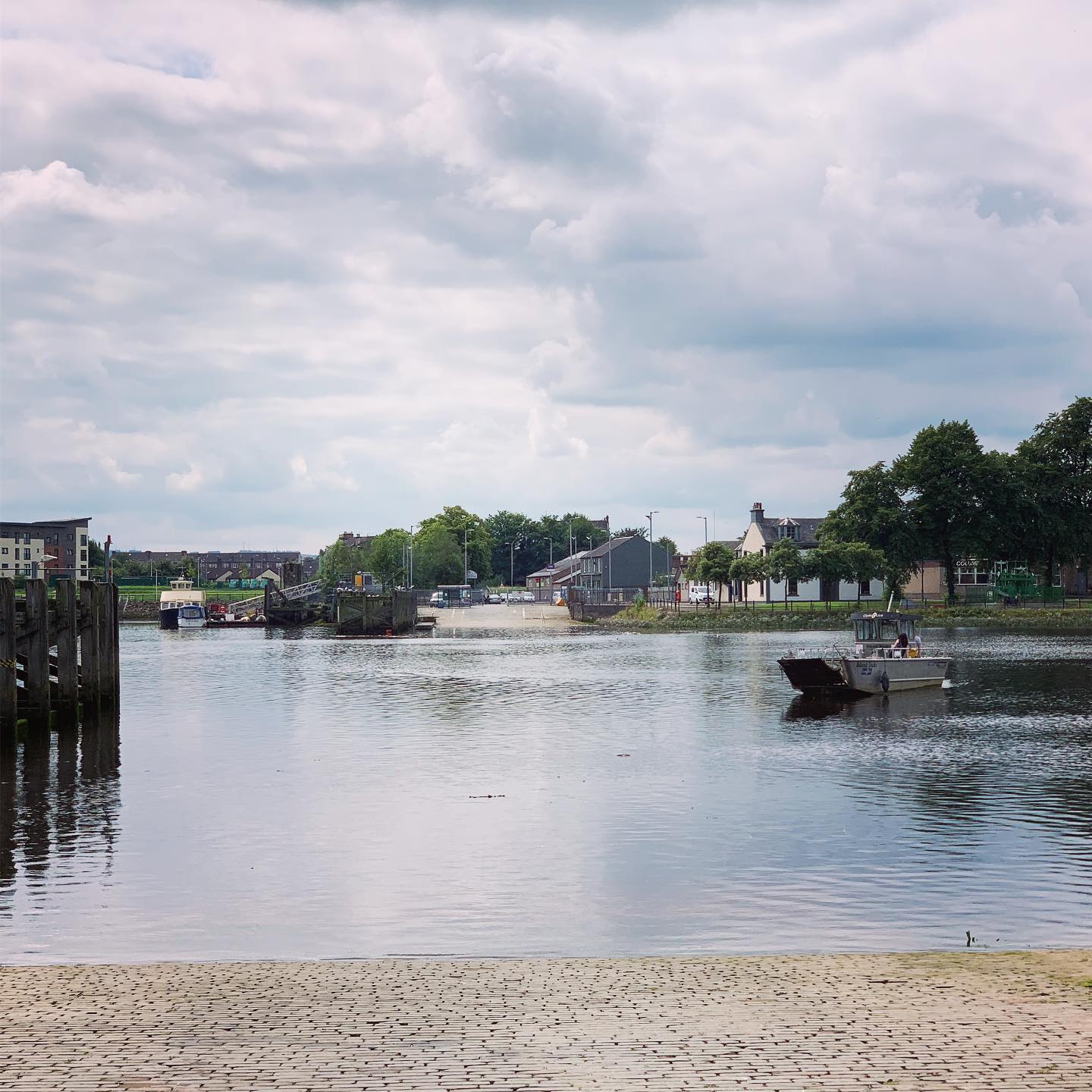
I used my Garmin to avoid the main roads and took us on a bit of a magical mystery tour through housing estates and an array of paths avoiding the main roads. This is when the map on the Garmin comes so handy. We then took the wee ferry across the Clyde and tracked a path around a golf course popping us out right by the airport. (Stats: 55km | 700m elevation).
All in all it has been a super adventure, across such different terrain with fab company.


Comments:
I love this! Thanks Jen.
You’d be fab as a travel journalist. Some of your photos are so beautiful and atmospheric.
Great read. Considering this with the kids so great to see how you split over 5 days. I may need to make it 6 however. Roughly how long did it take you each day breaks included?